
Stay in control.
Wherever your vehicles and assets are.
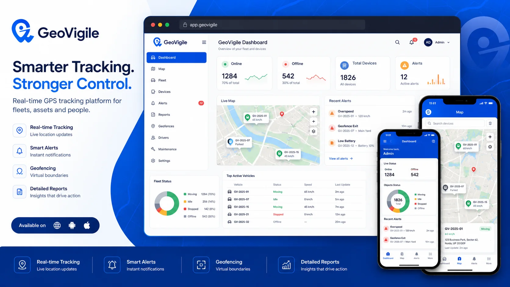
GeoVigile combines real-time location, alerts, route history, fleet management and connected GPS hardware in a simple web and mobile experience.
A device for every tracking use case.
GeoVigile selects tracking hardware from technology ecosystem GeoVigile. Exact functions depend on model and deployment.
GT06 4G
Vehicle tracking for live location, geofencing and fleet security.
View product →
W07 4G
Battery-powered magnetic tracker for assets and temporary installations.
View product →
GT10
Vehicle tracking, alerts and expansion interfaces for professional deployments.
View product →
H8
Rugged tracker with extended connectivity for demanding fleet environments.
View product →Turn location data into operational decisions.
Our hardware portfolio uses professional trackers, dashcams and telematics devices from our product portfolioship with GeoVigile.
Tracking built around your operation.
Transport & logistics
Track routes, stops, vehicles and operating events.
Equipment & assets
Monitor equipment, trailers, containers and high-value assets.
Security & anti-theft
Movement, geofence, power and tamper alerts depending on hardware.
Dashcam & video telematics
Combine video, GPS and driver events to improve road safety.
Rental & field service
Keep visibility on vehicles assigned to customers and mobile teams.
Personal tracking
Protect vehicles, motorcycles and personal assets with suitable hardware.
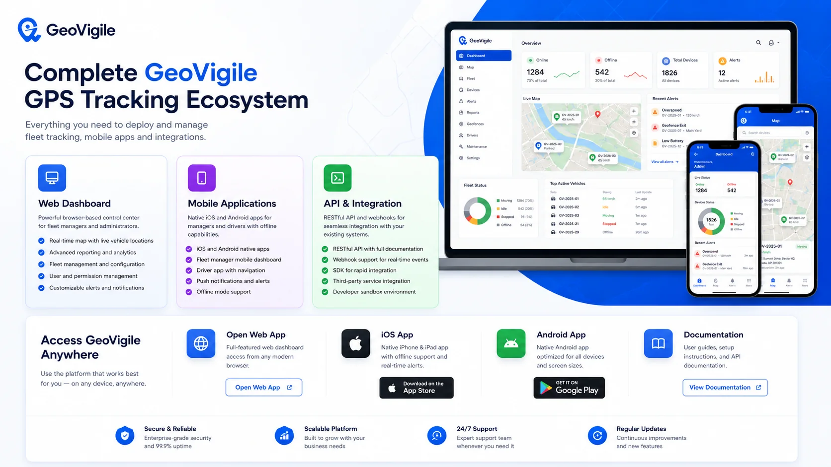
Complete GeoVigile GPS ecosystem.
Web dashboard, mobile applications and API integration in one tracking environment.
One platform structured around 4 pillars.
GeoVigile groups GPS capabilities into four clear operational blocks: visibility, operations, analytics and control.
Locate & secure
Understand what is happening in the field and react quickly to important events.
Operate & optimize
Turn GPS data into everyday fleet-management actions.
Analyze & manage
Measure activity and surface patterns that require decisions.
Administer & connect
Manage access, rules and data exchange with your business environment.
This structure makes it easy to understand how GeoVigile supports daily operations.
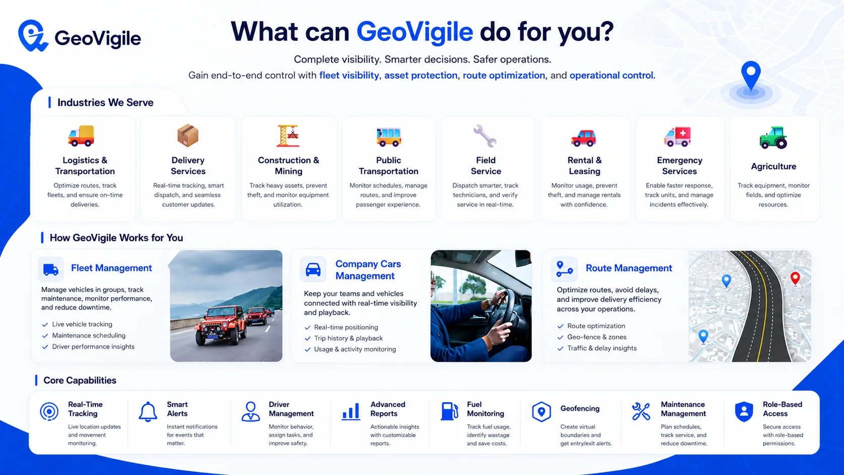
Use cases grouped by operating model.
The same GeoVigile building blocks are configured around each sector’s vehicles, assets, teams and constraints.
Transport & mobility
Movement, routes and vehicle availability.
Logistics & transportation
Routes, loads, punctuality and driver behavior.
Public transportation
Vehicle tracking, schedules, routes and service analysis.
Delivery & service
Coordinate mobile operations and field interventions.
Delivery services
Last mile, ETA, routes and delivery visibility.
Field service
Technician location, dispatch and service traceability.
Industry & assets
Protect and manage high-value or distributed equipment.
Construction & mining
Heavy equipment, assets, geofencing, usage and maintenance.
Agriculture
Equipment tracking, work zones and resource utilization.
Control & response
Security, availability and fast reaction to critical events.
Rental & leasing
Usage, mileage, returns, geofencing and anti-theft monitoring.
Emergency services
Unit location and coordination of operational resources.
Which GPS tracker fits your needs?
Tell us what you need to track. We will recommend the appropriate hardware and configuration.