
GPS solutions in Madagascar for vehicles, fleets and assets.
Combine GPS hardware, web/mobile tracking, alerts and fleet tools to manage vehicles and assets across Madagascar.
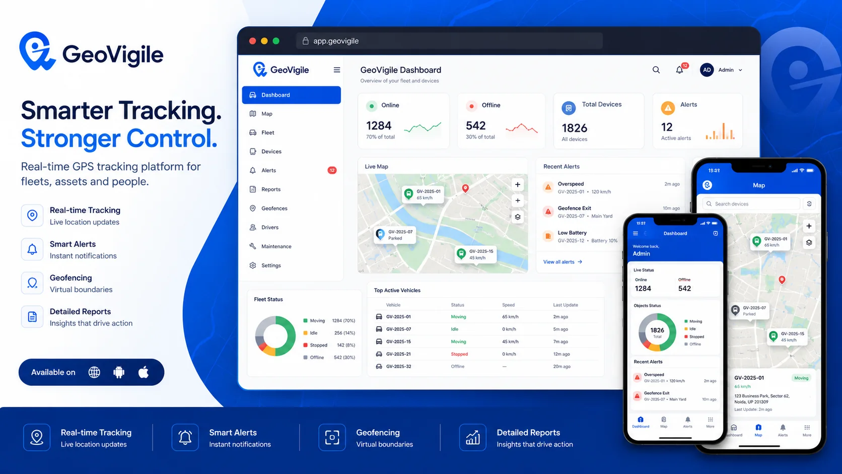
Turn tracking data into operational visibility.
GeoVigile combines connected devices, live maps, alerts, history and fleet tools around the requirements of each operation.
Real-time tracking
See vehicle and asset positions, status and recent events.
Geofencing & alerts
Create zones and automate important notifications.
Fleet management
Centralize vehicles, drivers, history, reports and maintenance.
Suitable trackers
Select hardwired, portable, battery or rugged hardware for the use case.
Web & mobile
Access tracking information from browsers and mobile apps.
API & integrations
Connect selected events and data to business systems when required.
From field requirements to an operational tracking setup.
Define the use case
Vehicles, equipment, assets, operating zones and required visibility.
Select hardware
Validate network, power source, autonomy and required accessories.
Configure GeoVigile
Set users, alerts, zones, reports and permissions.
Deploy & monitor
Install, test and use tracking data in daily operations.
Explore related GPS use cases.
Frequently asked questions
What GPS solutions are available in Madagascar?
GeoVigile supports vehicle trackers, portable devices, fleet tracking and asset monitoring.
Can several vehicles be managed from one account?
Yes, multiple devices can be organized within the same platform.
Does live GPS depend on mobile coverage?
Yes. Positioning and data transmission are different: real-time server updates require compatible mobile coverage.
Is GeoVigile suitable for business fleets?
Yes, with fleet views, reports, alerts, roles and maintenance features.
Planning a GPS tracking project in Madagascar?
Tell us what you need to track, where it operates and which events matter. We can recommend a suitable configuration.